Quiet tropics, Saharan dust could lower Houston rain chances Thursday
Saharan dust could trim Thursday rain chances in Houston while air quality worsens for sensitive groups and the tropics stay quiet for now.

A new plume of Saharan dust is expected to reach Southeast Texas by Thursday and linger into Friday, giving Houston and Harris County a drier, hazier stretch even as the tropics stay quiet. That matters for asthma sufferers, youth sports, and anyone hoping for afternoon showers to cool a hot July day.
The Houston/Galveston office of the National Weather Service said the dust should reduce air quality, especially for sensitive groups, while also producing hazy skies and brighter sunrises and sunsets. ABC13’s forecast update said the dust could cut Thursday’s rain chances to about 20 percent, a shift that may help keep outdoor plans dry but does little to ease the heat across the region.
The broader tropical picture remains calm. The National Hurricane Center said July 8 and July 9 that tropical cyclone formation was not expected over the next seven days in the Atlantic basin, the Caribbean Sea, or the Gulf of America. NOAA’s 2026 Atlantic hurricane season outlook, released May 21, called for a below-normal season, and the season runs from June 1 through November 30.
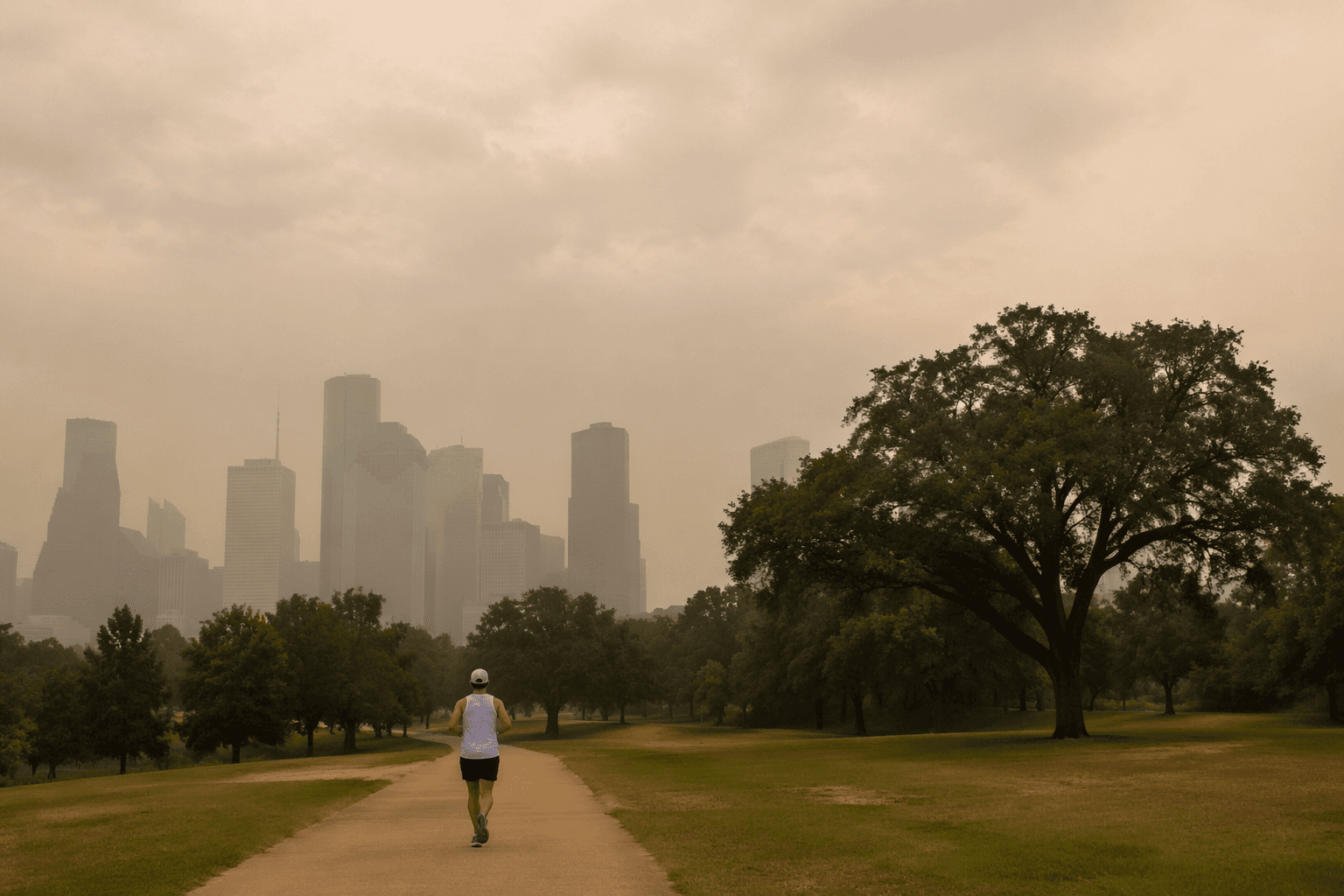
For families in Harris County, the immediate issue is less about landfall and more about daily routine. Dusty air can make breathing harder for children, older adults, and anyone with asthma, and it can turn a normal practice field or park outing into a rougher afternoon. In a county where weather can quickly change commutes, home projects, and sports schedules, a quiet tropics forecast still leaves room for practical disruption.
Rain chances are not disappearing for long. The National Weather Service said rain and thunderstorm chances should increase beginning Friday and continue into early next week, and ABC13’s weekend forecast put scattered thunderstorm chances at 40 percent each afternoon on Saturday and Sunday across parts of Southeast Texas. That means Thursday’s lower rain odds may be brief, with a wetter pattern returning soon after.

ABC13 also tracked an Eastern Pacific low-pressure area with formation odds rising from 20 percent to 40 percent. The system was not expected to affect land, but it adds another reminder that late-summer forecasts can shift quickly even when the Atlantic, Caribbean, and Gulf stay free of immediate tropical threats.
This article was produced by Prism’s automated news system from verified source data, official records, and press releases, then run through automated quality and moderation checks before publishing. The system is built and supervised by the people who set the standards it runs under. Read our full AI policy.
Did this article answer your question?